Day 5: Caye Caulker to Flores, Guatemala
Book your shuttle from Caye Caulker in advance, ideally through your hostel or a travel desk on Front Street. The standard route runs: water taxi from Caye Caulker back to Belize City (45 minutes, first departure around 8 am), connecting shuttle from Belize City to the Guatemalan border at Benque Viejo del Carmen/Melchor de Mencos, border crossing on foot, then onward shuttle to Flores. The full journey takes roughly eight to nine hours including the border crossing. E-Z Boy Tours, which operates out of Caye Caulker, is a well-established operator for this route and handles the shuttle-to-border-to-Flores connection as a single booking.
The border crossing: You pay an exit fee on the Belize side (approximately 40 BZD; pay at the departure window before crossing). On the Guatemalan side you fill in an entry card and pay nothing if you are from a visa-exempt country. The crossing is busy on weekday mornings; allow 45 to 90 minutes to get through. Keep your passport and any migration cards accessible throughout, not buried in your bag.
You arrive in Flores in the evening. Flores itself is a small island connected to the mainland town of Santa Elena by a 500-metre causeway. The island has a circular perimeter road and a handful of streets; you can walk the whole island in 15 minutes. Most restaurants and hostels are on the island itself.
Days 6 to 8: Flores and Tikal
Tikal: The site is 66 km northeast of Flores, roughly 90 minutes by road. Virtually everyone visits on an organised tour because the early morning logistics are easier with a driver and the guides add significant context that the site itself does not provide through signage alone.
The sunrise tour is the one to book. A typical timetable: pickup from your hostel in Flores at 3:30 to 4 am, arrive at the park gate before first light, enter with your guide in darkness. The Tikal entrance fee is Q150 (approximately $19 USD) plus an additional Q100 ($13 USD) for the sunrise access permit on top of the standard entry. Buy the sunrise ticket in advance from a Banrural or CHN bank in Flores town, not at the gate, because the ticket office at Tikal does not open until 7 am and you enter earlier than that on the sunrise tour. Your hostel can tell you the nearest branch and opening times.
The guide leads you in darkness to Temple IV, the tallest structure at Tikal at 70 metres and the one used in the Star Wars filming. You climb the wooden staircase to the upper platform in the dark, settle in, and wait. As first light builds, the canopy emerges below you in layers of green mist and the stone tips of other temples appear above the treeline to the south. Howler monkeys begin in the forest; their call sounds like something between a lion and a freight train and carries for two kilometres. Spider monkeys move through the canopy. Toucans cross the open air between trees. This takes 30 to 45 minutes before the sun is fully up and the heat begins. It is one of the more impressive experiences in Central America.
The guided walk after sunrise covers the main plaza, Temple I (Temple of the Great Jaguar), Temple II, the Northern Acropolis, the Lost World complex and several smaller structures across roughly four to five kilometres of jungle walking. The city covers 576 square kilometres of protected rainforest; what visitors see is the monumental core. At its peak around 700 AD, Tikal had a population estimated at 100,000 to 200,000 and controlled trade routes stretching across the Maya lowlands. The site was declared a UNESCO World Heritage Site in 1979.
Heat and humidity inside the park after 10 am are significant. Carry at least two litres of water, wear light clothes, and use insect repellent. The park is home to coatis, agoutis, kinkajous, ocelot and the occasional jaguar, none of which are commonly seen from the main paths.
Book your Tikal tour through Los Amigos Hostel on the island in Flores, which is the most well-organised and transparent operation for independent travellers. Prices as of 2025 through Los Amigos: Q130 for the tour guide plus Q150 for the day pass plus Q100 for the sunrise permit. Other tour agencies operate along the waterfront at similar prices; shop around and verify what is included before paying.
Jorge's Rope Swing: Across the lake from Flores, a family runs a rope swing and hammock bar accessible by a five-minute boat ride from the Flores waterfront. Los Amigos can arrange the boat, or you can negotiate directly with a boatman at the dock. There is a small entry fee of a few dollars. This is where people spend the afternoon after the Tikal early start: cold beers, a rope swing into the lake, watching the sun drop over the water. It is one of the more enjoyable afternoons on the whole route.
Flores practicalities: ATMs are on the island and in Santa Elena across the causeway; the Flores ATMs sometimes run dry. The Maya Mall shopping centre in Santa Elena has a reliable Supermercado La Torre and a Banrural. The Sky Bar on the island has the best views of the lake and cheap cocktails in happy hour.
Days 9 to 12: Semuc Champey and Lanquín
Getting there: A shuttle from Flores to Lanquín takes approximately seven to eight hours on a combination of sealed and unsealed road through the Guatemalan interior. The road into Lanquín itself is rough and winding for the final section and gets worse after heavy rain in the wet season. Most shuttle companies now use this route regularly and the condition has improved in recent years, but it remains a full travel day. Book through your Flores hostel the evening before; shuttles depart early morning around 6 to 7 am.
From Lake Atitlán, the shuttle to Lanquín takes 10 to 12 hours. From Antigua, eight hours. These are long days; build them in as genuine travel days rather than trying to arrive and immediately do anything.
On arrival in Lanquín, your hostel pickup should be waiting at the bus drop-off point in the village. Most hostels send a truck for guests. If not, tuk-tuks are available.
Zephyr Lodge: Sits on a hillside above the town, not directly in the village or beside the river. It has an infinity pool with the most dramatic jungle valley view of any hostel in Guatemala and a bar that runs loud until late. This is a party hostel; the social calendar is the appeal for many people and the deterrent for others. The private rooms with their own balconies overlooking the valley are the standout option if you want the setting without being directly next to the noise. Email in advance to request balcony-view rooms specifically. There is no shop nearby and no kitchen; all meals come from the hostel restaurant.
Alternative if Zephyr is not your speed: Utopia Eco Hotel sits closer to the Semuc Champey entrance and is vegetarian, quieter, set beside the river with natural swimming.
Semuc Champey: The natural monument is approximately 10 km from Lanquín along a road that improves each year. Transport options: tuk-tuk (cheaper, slower), camioneta (pick-up truck, Q5 each way, how locals travel), or hostel shuttle. The ride takes 30 to 45 minutes.
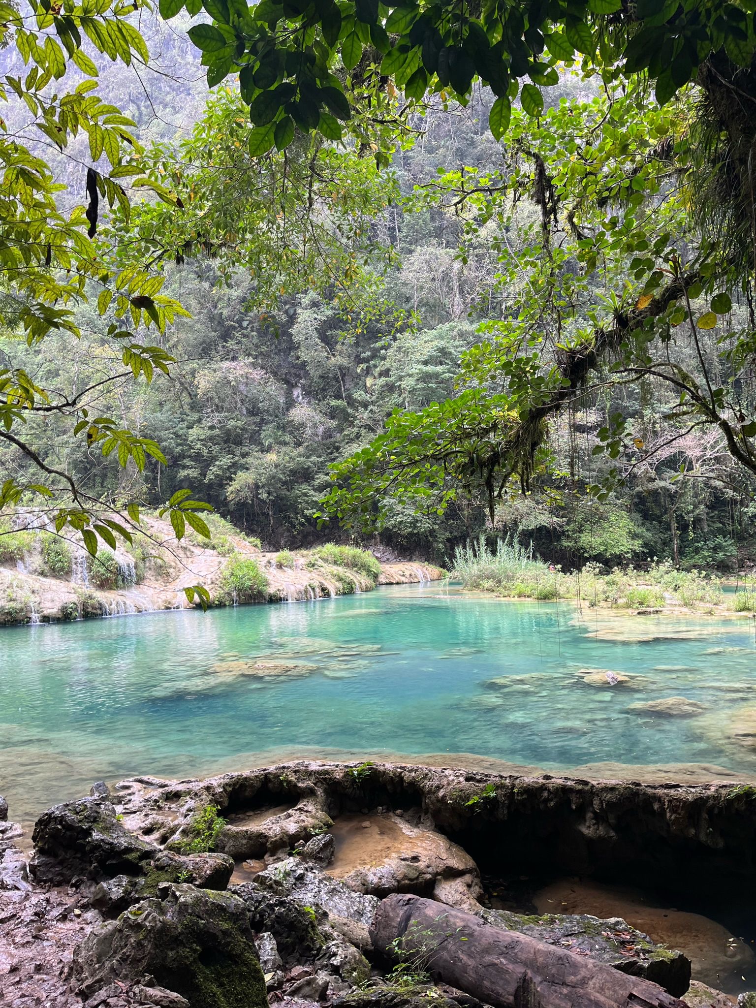
The formation itself: the Cahabón River disappears underground into a limestone cavern beneath a 300-metre natural bridge. On top of the bridge sit six stepped turquoise pools at different depths and temperatures, fed by smaller surface trickles and by water filtering up from the rock below. The colour of the water is a function of the mineral content and the depth of the limestone underneath. Entry costs approximately Q50 ($6 USD) for independent visitors. The monument is open 8 am to 4 pm.
The viewpoint (El Mirador) sits above the pools on a forested hillside and requires a 30-minute hike up a steep path. This is mandatory; the view from above is what makes the whole formation comprehensible. From the top you see the full span of the natural bridge, the river appearing and disappearing on either side, and the stepped pools across the limestone surface below. You do not need a guide for the pools or the viewpoint.
The cave (Kan'Ba): You do need a guide for the cave. The cave system sits upstream from the pools and involves wading, swimming and climbing through an underground river by candlelight. The guide carries the candles (bring waterproof shoes or sandals with grip; bare feet on wet rock in darkness is a bad idea). The experience is chaotic, slightly terrifying and deeply memorable: clambering over rock ledges with a candle in your fist, swimming through caverns where the ceiling drops to the water surface, pulling yourself up ropes in the dark. Cave tours run from Semuc every 30 minutes between 9 am and 3 pm. Book through Zephyr or directly at the Semuc entrance.
For the full Semuc day tour from Zephyr Lodge the package typically includes transport, both Semuc entrance and cave entrance fees, an English-speaking guide and a welcome-back beer: approximately Q200 to Q250 per person. The Fuego hike option to enter Volcán de Fuego on the Acatenango route costs extra.
River tubing: On the Cahabón River below the monument, inner tubes are rentable at the entrance for approximately Q50. The float takes around one hour downstream. It is lazy and pleasant and a good complement to the cave if you have the energy.
Practical notes: Dengue is present in this area; use repellent consistently and cover arms and legs at dusk. The water in the pools is safe to swim in; the tap water in Lanquín is not safe to drink. Bring enough cash for the full stay from Flores or Guatemala City; there is no reliable ATM in Lanquín. Mobile signal is poor to non-existent at most hostels.
Days 13 to 16: Lake Atitlán
Getting there: The shuttle from Lanquín to Lake Atitlán takes approximately 10 to 12 hours, usually involving a change in Cobán or Antigua. This is the longest road day on the itinerary. Book through Zephyr or a shuttle desk and depart early. You descend from the jungle heat of the Petén into the cooler highland air of the altiplano, passing through pine-forested ridges before the volcanic caldera suddenly opens below you.
Most shuttles arrive into Panajachel, the main lakeside town and ferry hub. From Panajachel, public lanchas (motorised boats) cross the lake to San Pedro, San Juan, San Marcos, Santa Cruz and other villages for Q25 to Q35 per person, running roughly from 7 am to 6 pm. Buy your ticket at the Panajachel dock after verifying the destination; lanchas sometimes leave when they fill rather than at fixed times. The crossing to San Pedro takes approximately 45 minutes.
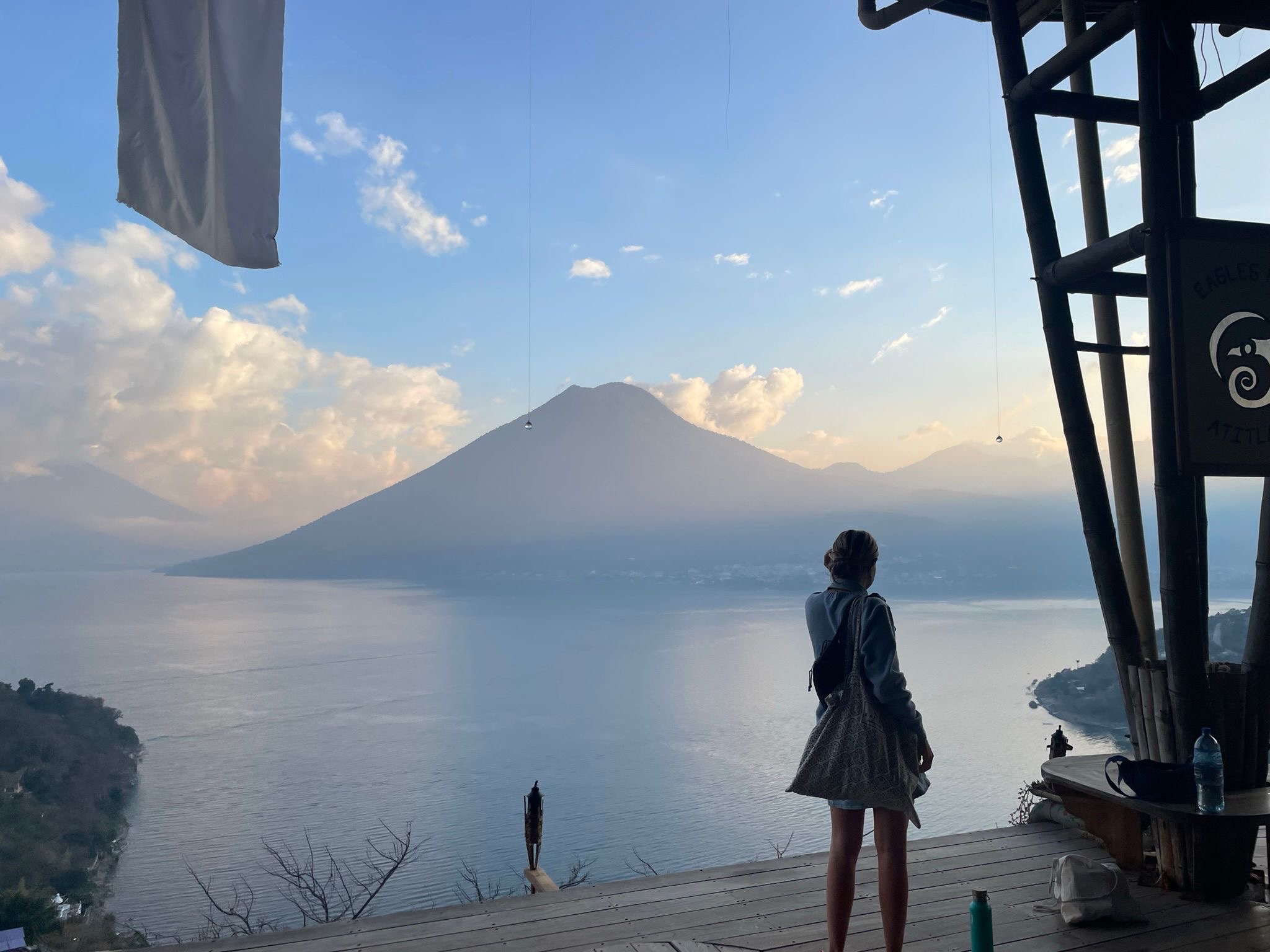
Orientation: Lake Atitlán sits in an ancient volcanic caldera at 1,560 metres above sea level, surrounded by three active volcanoes: San Pedro (3,020 m), Atitlán (3,537 m) and Tolimán (3,158 m). The lake is approximately 18 km wide and 340 metres deep at its deepest point. Thirteen Mayan villages are distributed around its shore, each with distinct indigenous cultures and languages. The lake has no natural surface outlet; water leaves entirely through evaporation and underground seepage.
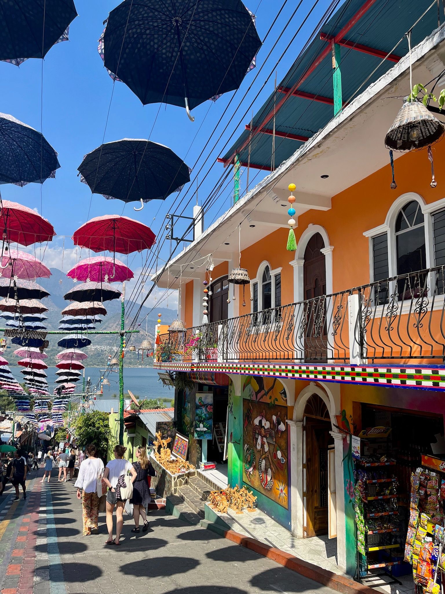
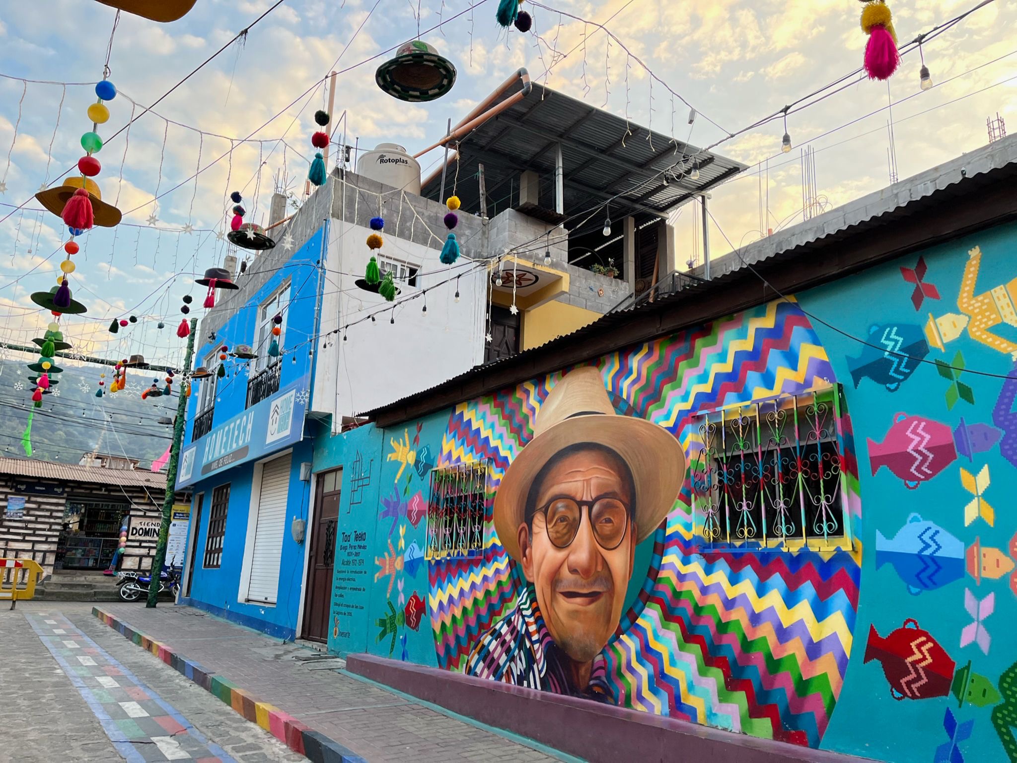
San Pedro La Laguna is where most backpackers base themselves: it has the most cafés, hostels, language schools, boat connections and evening options. San Juan La Laguna, a 20-minute walk along the shore or a short lancha ride west, is an indigenous cooperative town focused on weaving and street art. The Weaving Cooperative (AFEDES) on the main street gives organised tours of the natural dye workshop and the backstrap loom demonstration; it is run entirely by local women and the proceeds stay in the community. San Marcos La Laguna, further west, is where the yoga retreats, holistic centres and quieter guesthouses sit. The crossing from San Pedro by lancha takes 10 to 15 minutes and costs Q10.
Eagle's Nest viewpoint: Above San Marcos, a steep path climbs 20 minutes to a hostel and viewpoint with arguably the best lake panorama on the entire shoreline. The walk is uphill; a tuk-tuk can take you most of the way and costs Q10 from the San Marcos dock. Worth the effort.
Language schools: San Pedro has a cluster of Spanish language schools offering four hours of one-on-one tuition daily for approximately $125 to $200 USD per week. If you have the time, a week of lessons in San Pedro is one of the best ways to spend this section; you learn fast with full immersion, the teachers are local, and the setting is ludicrous. Book on arrival rather than in advance; all schools accept walk-in enrolment.
Practical notes: The lake itself is not safe to swim in unsupervised due to occasional strong subsurface currents called xocomil that appear without warning in the afternoon as cold lake air collides with warm surface air. Swim close to the shore and not in the middle of the crossing channels. Most hostels with private swimming areas are safe; ask locally. The altitude means cooler nights than you expect after the jungle; bring a layer.
Days 17 to 19: Antigua and Acatenango
Getting there: Shuttle from San Pedro to Antigua takes three to four hours via Panajachel and the Pan-American Highway. Book through any travel desk in San Pedro; shuttles depart most mornings around 7 to 8 am. Antigua sits at 1,540 metres in a valley ringed by three volcanoes: Agua, Acatenango and Fuego.
Antigua: The former Spanish colonial capital is compact and almost entirely walkable within its grid of cobblestone streets. Key orientation: the main plaza (Parque Central) is the centre point, with the Cathedral on the east, the Palacio de los Capitanes on the south and the market to the north. The city's defining visual feature is the partial ruins that appear throughout: colonial churches and convents shattered by earthquakes in 1773, partially stabilised and left open as archaeological sites. Santa Catalina Arch is the most photographed; the ruins of La Merced and El Carmen are more atmospheric to actually walk through. Entry to most ruins is Q5 to Q20.
The Mercado Municipal (the central market, two blocks north of the main plaza) is the practical food and produce market. Maya Papaya Hostel runs a free market tour for guests on weekend mornings; it is worth joining for the vendor introductions rather than the logistics. La Bodegona on 4a Calle Oriente is the main supermarket; useful for self-catering between restaurant meals.
Acatenango overnight hike: This is the defining experience of Antigua, logistically and physically the most demanding activity on the entire 19-day route. Do not attempt it independently without significant high-altitude hiking experience; the trail requires a guide for navigation and safety, the mountain is active and conditions change fast.
Structure: The hike departs in the morning (typically 7 to 8 am from Antigua with pickup from your hostel or operator). The ascent from the trailhead at La Soledad village takes four to six hours through three distinct zones: coffee and vegetable farms on the lower slopes, cloud forest mid-mountain where the temperature drops sharply and the trail becomes steeper, and then open volcanic scree above the treeline. You reach base camp at approximately 3,800 metres. The total elevation gain is around 1,800 metres from the trailhead.
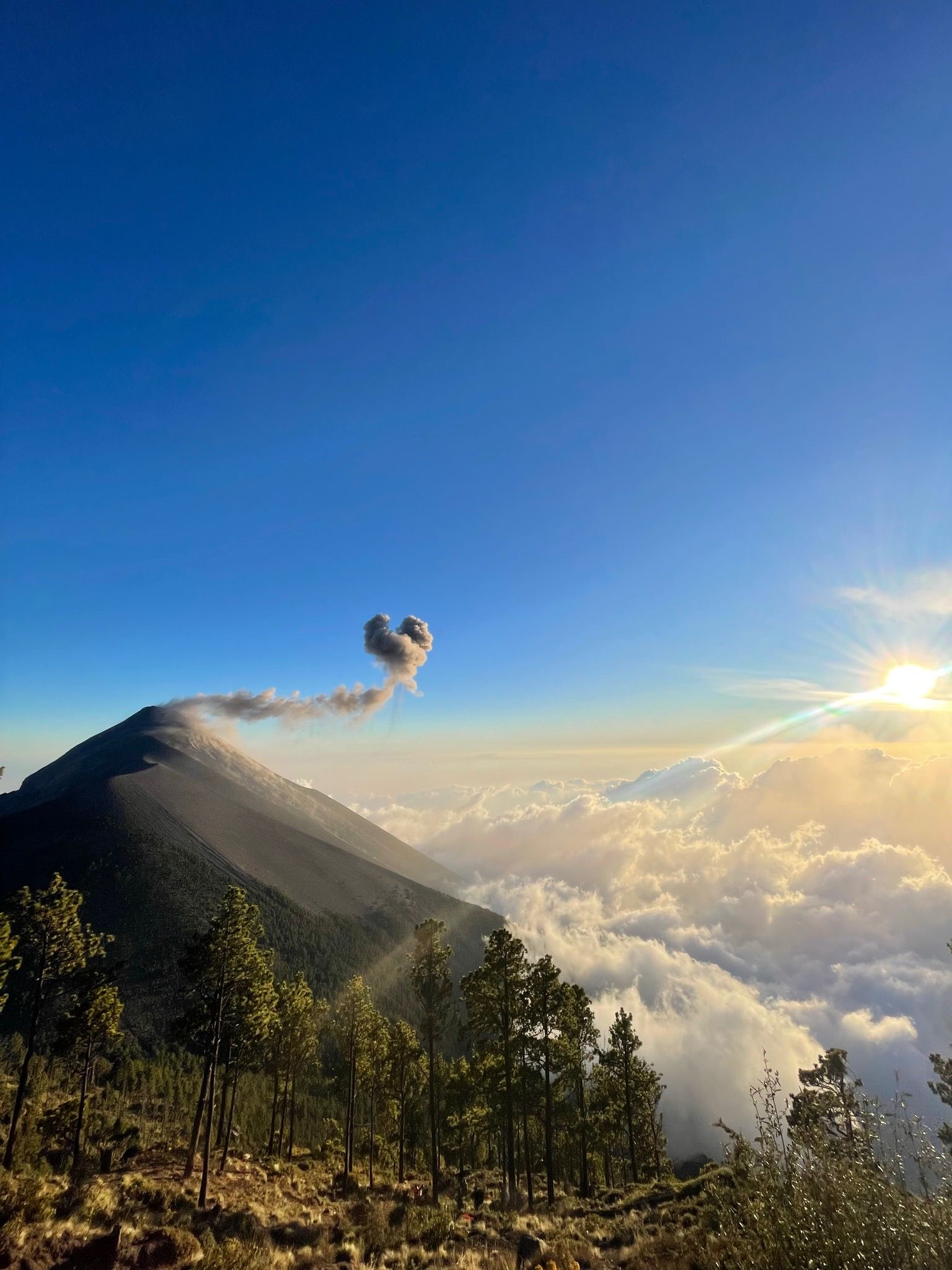
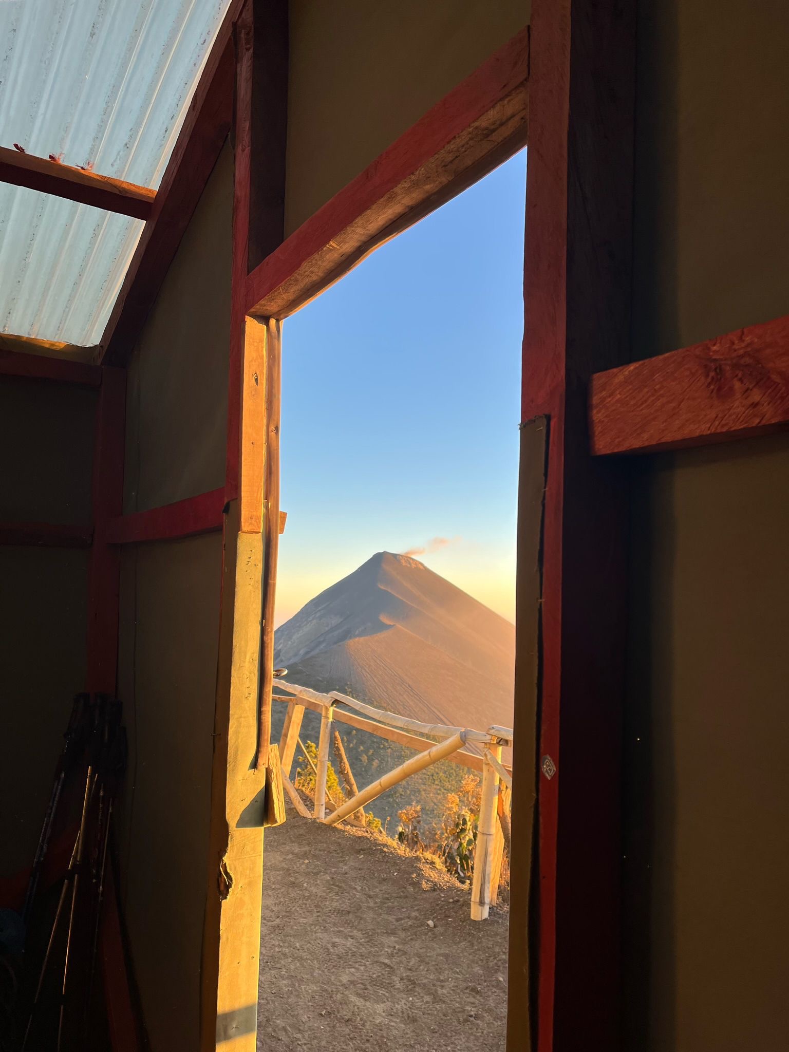
At base camp, you eat dinner, rest briefly, and then at approximately 4 pm (if you book the Fuego hike option) you set out again for a further two-hour traverse across the saddle between Acatenango and Fuego to a viewpoint directly facing the active volcano. Fuego erupts roughly every 15 to 45 minutes with columns of smoke and, after dark, visible lava flows and pyroclastic material streaking down the cone. Watching this from 400 metres away in darkness is one of the most visceral natural experiences in Central America. Return to base camp, sleep.
At approximately 4 to 4:30 am the next morning, the final push to the Acatenango summit at 3,976 metres. Temperature at the summit before dawn is often below freezing with significant wind. The sunrise view from the top covers multiple volcano chains on clear days: Agua directly below, Santa María and Santiaguito far to the west, the Pacific coast visible beyond.
Descent: three to four hours back to the trailhead, arriving in Antigua by early to mid-afternoon.
Operators: Wicho and Charlie's is the most consistently reviewed operator on the mountain. They built the first permanent base camp on Acatenango and operate wooden cabins rather than tents; this is significant in cold and wet conditions. Their overnight package including the Fuego hike option costs approximately $90 to $130 USD per person depending on group size and cabin type. They include gear rental (warm jacket, hat, gloves, sleeping bag) in the price, which is essential for backpackers who have not carried cold-weather gear through Central America. Book directly at their office on 6a Avenida in Antigua, not through third-party sites. OX Expeditions is the other consistently well-reviewed option at a similar price; their guides are bilingual and their ethics around porter pay and environmental practice are explicit.
The Fuego hike to the viewpoint costs an additional Q200 ($26 USD) on top of the standard overnight fee. Do not skip it. The eruptions at night are the reason people remember this hike.
What to carry: Layers are essential. Even if you have been hiking in shorts throughout this route, the temperature at 3,800 metres overnight with Patagonian-style wind is genuinely cold. Operators provide gear but bring your own base layer if you have one. Trekking poles are available to rent and make the descent on loose scree significantly less painful. Book your hostel bed in Antigua for the night of the hike so you can leave non-essential luggage there and return to a hot shower and a bed rather than waiting for check-in.
Final days in Antigua: Use the remaining days at your own pace. Walk the ruins, eat at Once Once (one of the better mid-range restaurants for a post-hike reward dinner), drink at the rooftop bars around the main plaza, and visit the Mercado for fresh fruit and final souvenir shopping. La Bodegona is well stocked for self-catering if your stomach needs a break from restaurant food after the hike.
.png)