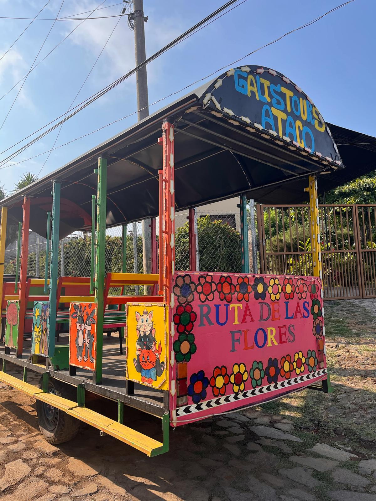
Day 3: Juayúa and the waterfalls, then Ataco
Leave El Tunco by 7 am. The drive north into the Ruta de las Flores from the coast takes approximately one hour, climbing from the Pacific heat into the highland coffee country. Temperatures drop noticeably as the road climbs; bring a layer for the morning.
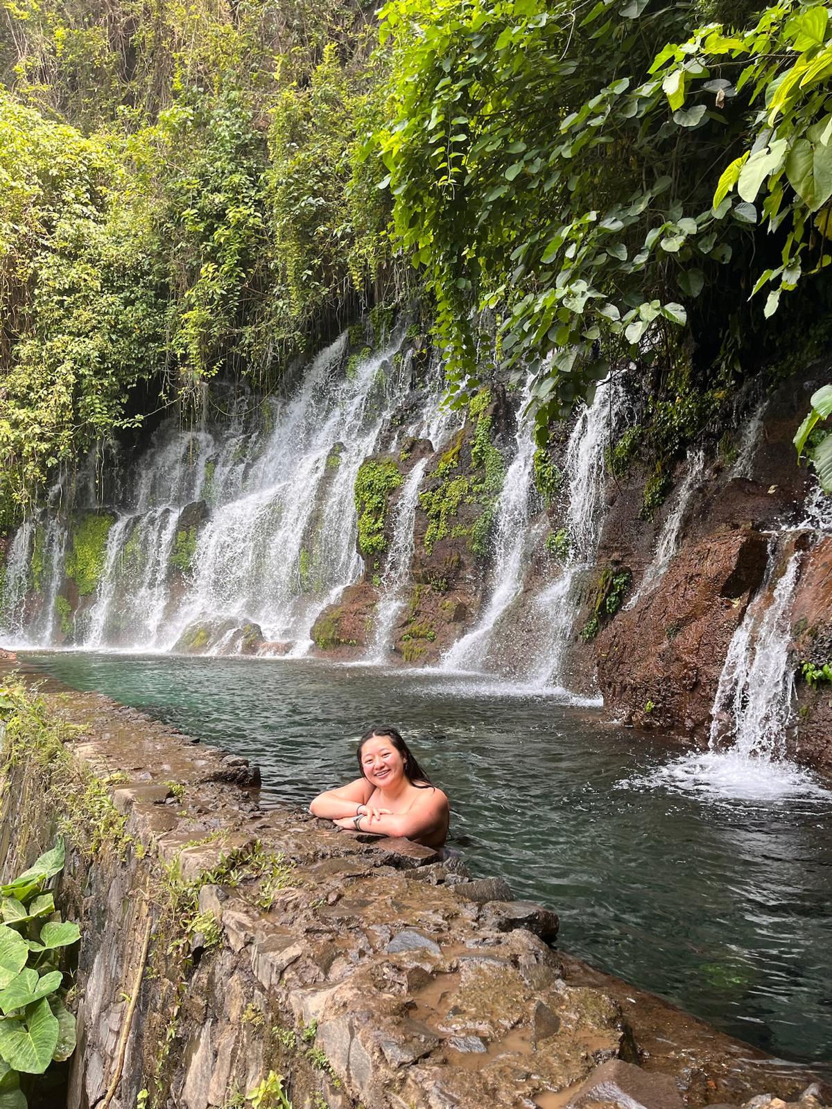
Juayúa (pronounced wha-YOO-wah) is the first major town on the Ruta de las Flores and the base for the Seven Waterfalls hike (Siete Cascadas or Los Chorros de la Calera). The hike begins approximately 3 km from the town centre and descends through a private finca with a guide from the local community. The full circuit covers all seven waterfalls across approximately 4 to 5 hours of hiking through cloud forest and along stream beds, with swimming possible at multiple pools. The trail requires some scrambling and stream crossings; waterproof sandals or light hiking shoes are necessary.
If time is limited, the first two waterfalls take approximately 90 minutes and give a strong sense of the canyon and the swimming without committing to the full day. The full hike is worth the time if you have it; arriving early and doing the complete circuit before noon is achievable if you are driving from the coast at 7 am. Entry fee for the hike is approximately $5 per person plus tip for the guide. Book through the tour desk at your hostel the evening before or simply arrive at the trailhead where guides are available on most mornings.
Juayúa's Parque Central is worth 20 minutes: the colonial church, the market stalls on weekends and the coffee shops along the main street. The town runs a famous weekend food festival (Feria Gastronómica) every Saturday and Sunday where dozens of vendors sell traditional Salvadoran dishes, grilled meats, seafood and local specialities from tables around the square. If your timing aligns, it is one of the more enjoyable street food experiences in the country.
From Juayúa, drive south to Concepción de Ataco, approximately 20 minutes. Ataco is the Ruta de las Flores town with the most developed visual identity: street murals cover the buildings with large-scale paintings (the murals in and around the Parque Central are the most concentrated), artisan workshops sell embroidery, woven textiles and leatherwork directly from the people who make them, and the overall density of things to look at per block is higher than anywhere else on the route. Walk the streets around the main park and the Mirador de la Cruz, a short uphill walk from the centre, for views over the coffee hills toward Guatemala.
Ataco is the correct overnight base for the Ruta de las Flores section. Staying here means you can walk the town after the day-tripper minibuses leave in the late afternoon, when the streets are quieter and the light on the colonial buildings is better. Evening pupusas at a local comedor and a coffee at one of the Ataco cafés with views over the valley is the right pace for this night.
Day 4: Ruta de las Flores complete, overnight at Lake Coatepeque
Work north through the remaining Ruta de las Flores towns, using the car to move at your own pace rather than the bus timetable.
Nahuizalco: The northernmost town and the most indigenous in character. The town is associated with the Nahua people and retains traditions of wicker weaving, palm-leaf work and rattan furniture making that are visible in the workshops on the main streets. The night market (Mercado Nocturno) runs on Friday and Saturday evenings and is one of the most atmospheric markets in the country. Nahuizalco is 20 km north of Juayúa, a 30-minute drive.
Salcoatitán: A small, quiet town between Nahuizalco and Juayúa with a beautiful 18th-century church on the main square and a mirador that gives one of the cleaner views over the coffee-growing valley below. Brief stop, 20 to 30 minutes.
Apaneca: The highest town on the route at approximately 1,500 metres, noticeably cooler than the rest of the circuit. Laguna Verde is a volcanic crater lake 3 km from the town centre reachable by car or taxi; the lake sits in a forested hollow and the surrounding area is quiet and genuinely beautiful without the crowds of Coatepeque. Los Enganches zip-line park outside Apaneca runs through cloud forest and offers the most dramatic zipline experience on this route, crossing valleys above coffee plantations. Two-hour sessions cost approximately $25 per person. The road through Apaneca toward the laguna also passes the El Carmen coffee estate, which runs guided tours of the full bean-to-cup production process.
In the afternoon, drive west from Apaneca toward Lake Coatepeque. The descent from the highlands to the lake takes about 45 minutes. The road winds down volcanic hillsides before the lake appears: a sudden opening of deep blue water entirely enclosed by forested crater walls.
Captain Morgan Hostel on the lakeshore is the traveller base and the itinerary's recommended overnight: a well-run hostel with lakefront access, jet ski hire, kayaks, hammocks and a bar that runs on the day's energy. Renting jet skis in the last hour before sunset and running across the lake as the light goes gold on the water is the defining experience of this stop. Cost approximately $50 to $80 per hour for a jet ski. No reservation system; arrive, check in, rent on the day. The lake is surrounded by private residences and weekend homes of San Salvador's upper-middle class; the Captain Morgan hostel occupies its own stretch of shoreline and is the most accessible option for independent travellers without a local contact on the lake. Alternative options exist (Amacuilco Hotel and Resort, and several private villas on Airbnb) but Captain Morgan remains the most social and traveller-focused.
Day 5: Santa Ana Volcano at dawn, afternoon at the lake
This is the day that requires the most careful timing. The Santa Ana volcano hike is 4 to 5 hours round trip from the Cerro Verde National Park trailhead; leaving the trailhead after 9 am means arriving at the summit after the cloud typically rolls in, which reduces visibility at the crater significantly. The correct approach: leave Lake Coatepeque by 6:30 am, drive to the Cerro Verde trailhead (approximately 25 minutes from the lake), and begin the hike by 7 to 7:30 am.
A guided group tour operates daily from the trailhead; individual guides are also available. Both options cost approximately $10 to $15 per person for the guide. The guide is mandatory by park regulation and also useful; the trail is well-marked but the guides add volcanic history, ecological context and good judgement about conditions near the crater rim. Buy your park entry ticket at the Cerro Verde trailhead entrance: approximately $6 per person for foreigners as of 2025.
The ascent from the trailhead to the summit at 2,381 metres covers approximately 4.5 km with 600 to 700 metres of elevation gain. The first section passes through cloud forest: cool, shaded, with birds (including toucans on good days) moving through the canopy. The upper section breaks into open volcanic rock; there is no shade from this point and the sun exposure is intense. Apply sunscreen before you leave and carry at least two litres of water per person.
The summit: the crater rim looks directly down into the turquoise lake, which sits in the caldera approximately 300 metres below the rim. The colour shifts between green and blue depending on the light angle and sulphur concentration. The views from the rim extend to Lake Coatepeque directly below (one of the most satisfying geographical revelations on the route: you were swimming in that lake three hours ago), the Izalco volcano to the south, and on clear mornings the Pacific coast.
Do not rush the summit. Allow 30 minutes at the top before the descent; the descent on the loose volcanic rock and soil takes roughly as long as the ascent and is harder on the knees.
Return to Lake Coatepeque by early afternoon. Swim, use the hostel's hammocks, eat lunch by the lake. The afternoon at the lake after the volcano is the natural decompression the day requires.
Day 6: Drive to Suchitoto
Suchitoto is approximately 90 minutes east of Lake Coatepeque via Santa Ana city and then north on the CA-3 highway through the Cuscatlán department. Leave by mid-morning.
Suchitoto sits at 400 metres above the northern plains, its cobblestone streets and whitewashed colonial buildings looking north over Lake Suchitlán. The town was one of the most fought-over in the Salvadoran Civil War (1979 to 1992) and the cultural organisations and community arts infrastructure that emerged from the post-war recovery give it a distinctly alive quality that purely colonial heritage towns sometimes lack. The Teatro Municipal, the Centro Arte para la Paz, and the multiple galleries and workshops throughout the old town are all functioning institutions rather than preserved remnants.
The Iglesia de Santa Lucía on the main square is the most photographed building in El Salvador: a white Spanish colonial church dating from the 18th century with twin towers and an elaborate facade. Arrive in the late afternoon when the light hits the facade directly from the west. The Parque Central in front of it is where the town's social life happens; sit for 30 minutes and the rhythm of the place becomes clear.
Lake Suchitlán (also called Lago Suchitlán) is a reservoir created in 1976 when the Cerrón Grande dam was built across the Lempa River, flooding the former river valley and submerging several villages. The result is a haunting and beautiful landscape: forested islands (formed from former hilltops), flooded areas where dead trees rise from the water, and in some places the towers of colonial churches visible above the waterline. Boat tours leave from Puerto San Juan below the town; the standard 90-minute tour covers the main islands, the flooded forest and the birdlife (herons, kingfishers, white ibis and over 60 migratory species use the lake). Cost approximately $15 to $25 per person depending on group size. Go in the late afternoon when the light on the flooded landscape is most atmospheric.
Day 7: Los Tercios, indigo workshop and market
Los Tercios waterfall is 2 km south of Suchitoto centre, accessible by a 20-minute walk or short taxi ride. The waterfall drops about 20 metres over a face of hexagonal basalt columns, the same type of geological formation found at Iceland's Stuðlagil Canyon and Northern Ireland's Giant's Causeway, here at significantly smaller scale but genuinely striking. The basalt columns form when lava cools slowly and contracts; the geometric regularity against the organic chaos of the surrounding jungle is what makes it photogenic. A small natural pool at the base is swimmable. Entry is free or a minimal donation; a local guide from the community is available and useful for the context.
Indigo workshops: Suchitoto is one of the few remaining places in El Salvador where traditional indigo dyeing (añil) is still practiced. The Centro Arte para la Paz on the main street runs workshops where you can learn the resist-dyeing process; the indigo dye comes from the añil plant that was El Salvador's main export crop in the colonial period before coffee. The workshops run approximately 2 hours and cost $10 to $20 depending on the project. Book the day before at the centre. The resulting textile is genuinely made by hand and a more specific souvenir than anything sold in the market.
The Municipal Market on Saturday morning is the most local shopping experience in town: produce, crafts, textiles and street food. The pupuserias around the central park are the cheapest and best eating in Suchitoto; a plate of pupusas with curtido (fermented cabbage slaw) and salsa roja costs approximately $1.50 to $2.50.
Day 8: Return to San Salvador and departure
Suchitoto to the airport is approximately 60 to 75 minutes via the CA-3 south to the ring road and then east to the airport. The road is straightforward. Allow three hours before any international departure flight; the airport is well-organised but the security and immigration queues can lengthen significantly during busy morning departure windows. Return the rental car at the airport before check-in; most rental companies have desks in the terminal car park area and the return process takes 15 to 20 minutes.
If your flight is late afternoon or evening, use the morning for the Parque Cuscatlán and the Museo Nacional de Antropología David J. Guzmán in San Salvador, both within 20 minutes of the airport. The museum covers pre-Columbian Salvadoran history and is free to enter. The Mercado Central in San Salvador's historic centre is the place for a final lunch of pupusas, yuca frita or tacos de carne at street prices.
.png)
.jpeg)

.jpeg)
.jpeg)
.jpeg)
.jpeg)
.jpeg)
.jpeg)
.jpeg)
.jpeg)
.jpeg)
.jpeg)
.jpeg)
.jpeg)
.jpeg)
.jpeg)
.jpeg)
.jpeg)
.jpeg)
.jpeg)
.jpeg)
.jpeg)