Days 2 to 3: Jinja and the Nile
Drive east from Kampala on the Kampala-Jinja highway, 80 km and about 90 minutes on good tarmac. Jinja sits on the northern shore of Lake Victoria where the White Nile begins its 6,650 km journey to the Mediterranean. The source, marked with a small monument on an island visible from the riverbank, was identified by John Hanning Speke in 1862. The town's colonial-era commercial centre, built when Jinja was East Africa's industrial heartland, has a faded grandeur and a nostalgic atmosphere entirely different from Kampala's intensity.
Day 2 afternoon: Boat trip on the Source of the Nile. The excursion launches from the Nile waterfront and moves downstream past the source monument through papyrus-fringed channels where the birdlife is exceptional: African fish eagle, pied kingfisher, grey crowned crane, malachite kingfisher, and in the papyrus edges, papyrus gonolek and papyrus canary. The Nile Discovery Stretch waterfront strip of bars and restaurants is the right place for the evening.
Day 3 all day: White-water rafting the Upper Nile. One of the most accessible full-day rafting experiences in the world. The main operators, Adrift and NRE Adventures, run from bases near the Bujagali Falls area through a series of Grade 3 to Grade 5 rapids. The Bad Place rapid (Grade 5) is described at the pre-rafting briefing with particular emphasis and lives up to its name. The full day includes safety briefing, experienced guides, all equipment, a riverside picnic lunch and a safety kayak alongside every raft. Most people end the day with bruises they do not remember getting and a strong desire to go again immediately.
Stay at Source of the Nile Hotel both nights, well-positioned on the waterfront.
Days 4 to 5: Murchison Falls National Park
Drive northwest from Jinja to Murchison Falls, approximately 250 km on the highway toward Gulu and then into the park, four to five hours including gate formalities. The landscape changes as you leave the Lake Victoria basin: banana plantations give way to drier acacia woodland and eventually the broad, palm-studded savannah of the Nile valley. Murchison Falls National Park covers 3,893 square kilometres and is named for the waterfall where the full volume of the White Nile is forced through a seven-metre gap in the Rift Valley escarpment, dropping 43 metres in a plume visible from kilometres away.
Day 4 afternoon: Arrive at Pakuba Safari Lodge on the east bank of the Nile, 20 km downstream from where the river exits Lake Albert. Evening game drive along the delta circuit in golden late light: lions, Rothschild's giraffes, Uganda kob and oribi all use this section, and the animals coming to drink from the river in the final hour before dark consistently produce the best sightings of the stay.
Day 5 morning: Early game drive at first light. The Buligi circuit north of the Nile is the most reliably productive section. Rothschild's giraffe are essentially guaranteed; lions are regularly seen on the open plains. Shoebill storks, the prehistoric boat-billed waders that are among the most sought-after birds in Africa, inhabit the papyrus swamps around the Nile delta and require a separate boat trip from the delta launch site to find properly.
Day 5 afternoon: Boat trip from Paraa landing upstream to the base of Murchison Falls. The two-hour cruise passes hippo pods (one of Africa's largest concentrations), massive Nile crocodiles on every bank, elephants at the water's edge and hundreds of waterbirds. The waterfall appears as a white column of spray above the gorge before you round the final bend and the full scale arrives. The 430-metre hike from the boat landing to the top of the falls is optional but excellent.
Stay at Pakuba Safari Lodge both nights.
Days 6 to 7: Kibale National Park
Drive south from Murchison through the Nile valley and west toward Fort Portal, approximately four hours. The road crosses the foothills of the Rwenzori Mountains, the Mountains of the Moon that mark the western boundary of Uganda and the eastern edge of the Congo Basin. Fort Portal is worth a lunch stop; the surrounding landscape of tea plantations, crater lakes and rainforest hills is some of the most beautiful in Uganda.
Kibale National Park covers 795 square kilometres of lowland tropical forest in the Albertine Rift foothills and contains the highest density of primates of any East African forest, including 13 primate species. The habituated chimpanzee community here has been tracked and studied since 1987.
Day 7 morning: Chimp trekking. Groups of up to six enter the forest with a ranger guide and experienced trackers at first light. The chimpanzees carry on with their lives regardless of the humans below; watching a community groom, nurse, quarrel, and travel through the canopy is one of the most disorienting wildlife encounters in East Africa, the similarity to human behaviour constant and unavoidable. A dominant male at full size weighs approximately 60 kg; the pant-hoot vocalization carries two kilometres through the forest. Permits cost $250 per person as of 2025 and must be booked in advance.
Day 7 afternoon: Bigodi Wetland Sanctuary. A community-managed wetland bordering Kibale's southern boundary. The guided walk typically produces five or more monkey species in a single afternoon: red colobus, L'Hoest's monkey, grey-cheeked mangabey, red-tailed monkey and olive baboon are all resident. The birdlife is exceptional, particularly in the papyrus channels where great blue turaco, black-and-white casqued hornbill and papyrus gonolek are regular.
Stay at Crater Safari Lodge both nights, overlooking a forest-fringed crater lake.
Days 8 to 9: Queen Elizabeth National Park
Drive south from Kibale toward the equator and Queen Elizabeth National Park, approximately two to three hours. The road crosses the equator; there is a roadside monument. Queen Elizabeth covers 1,978 square kilometres between Lake George and Lake Edward, the Kazinga Channel connecting the two lakes through the park's centre. Over 600 bird species have been recorded here, one of the highest counts of any protected area in Africa.
Day 8 afternoon: Arrive at Simba Safari Camp and do an afternoon game drive on the Kasenyi Plains north of the channel. Lion prides are active here and elephants move between the forest patches in the first and last hours of light.
Day 9 morning: Early game drive on the Kasenyi Plains at first light, the most productive slot for lion and elephant.
Day 9 afternoon: Boat trip on the Kazinga Channel. The 40 km channel is arguably the best two-hour wildlife spectacle in Uganda. Hippos surface, grunt and jostle at close range throughout; elephants and buffalo come to drink from the far bank; fish eagles, goliath herons, yellow-billed storks and African skimmers work the shoreline. The western section gives views of the Rwenzori snow-caps on a clear day.
Stay at Simba Safari Camp both nights.
Day 10: Ishasha game drive and drive to Bwindi
Leave camp early for the two-hour drive south through the park to the Ishasha sector. Ishasha is famous for its tree-climbing lions: two prides habitually rest in the branches of the large fig trees along the Ishasha River. Nobody is entirely certain why the Ishasha lions climb; current theories involve avoiding ground insects and staying cool in an elevated breeze. Sightings are not guaranteed but are frequent, particularly in the morning when lions have finished hunting and moved into the trees for the day.
After the Ishasha game drive, continue south through the park and into the highlands toward Bwindi. The landscape becomes dramatically steeper: terraced farms clinging to impossible gradients, valleys so deep the bottoms disappear in cloud. Check into Gorilla Safari Lodge by late afternoon, with views toward the forest slopes of the park.
Day 11: Gorilla trekking at Bwindi Impenetrable National Park
Set your alarm for 5 am. The Uganda Wildlife Authority briefing begins at 7 am at the ranger station; groups of eight maximum are assigned to specific habituated gorilla families and depart with a lead ranger and two armed scouts.
The trekking varies from 30 minutes to six hours depending on where the gorillas have moved overnight. The rangers track the family's sleeping nest site from the previous evening and begin following the trail from there. The forest interior is genuinely impenetrable in the non-tourist sections: interlocking undergrowth, fallen trunks, steep ridges, mud. Good boots, long sleeves and trekking poles make a significant difference.
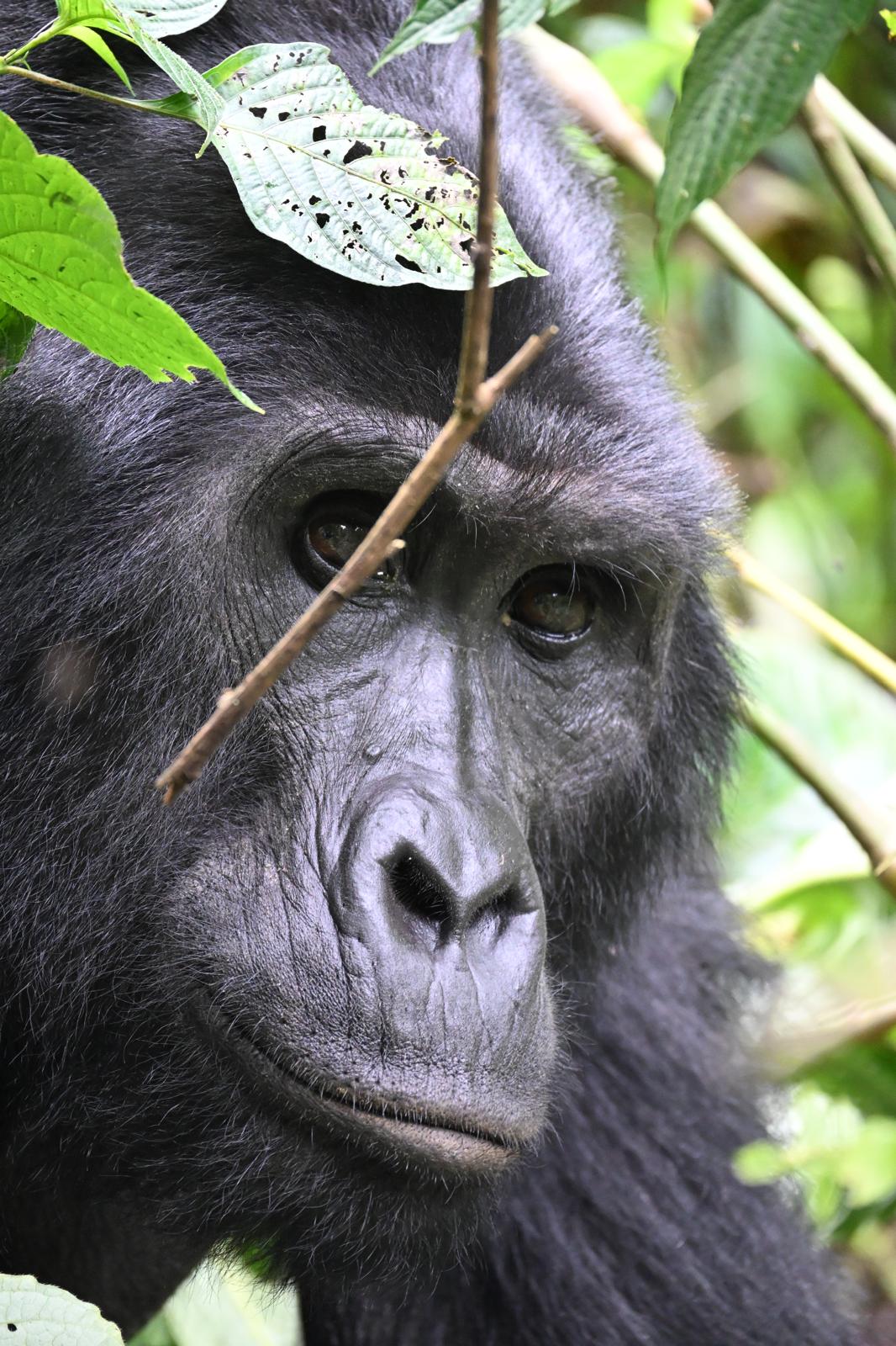
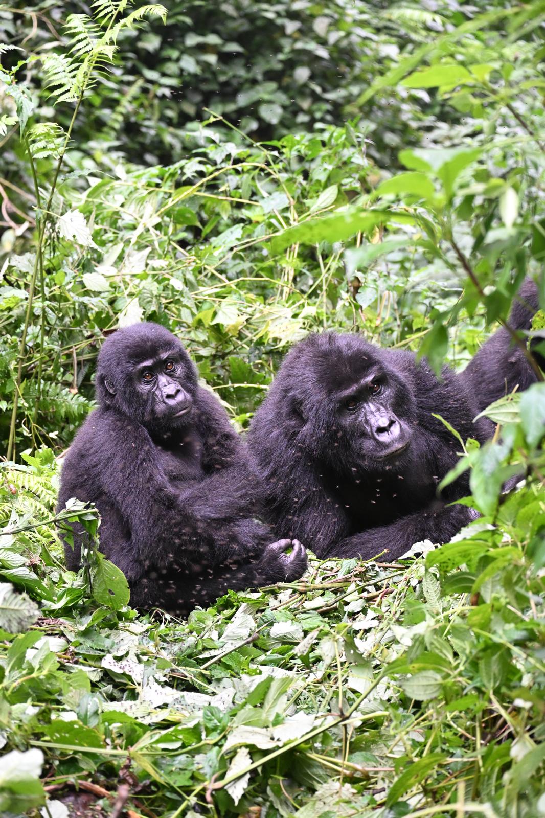
When you find the gorillas, you have one hour. The Uganda Wildlife Authority enforces this strictly. During that hour, infants wrestle and fall off branches, juveniles stare at the humans with undisguised curiosity, females nurse, and the silverback either ignores the group entirely or performs a brief chest-beat display to establish that he has noticed you and is unbothered. A silverback weighs between 140 and 220 kg; at the required seven-metre minimum approach distance, the experience of simply existing in the same clearing is unlike anything else in wildlife tourism. The permit costs $700 per person as of 2025 and must be booked months in advance through the Uganda Wildlife Authority.
Return to the lodge for lunch and a long afternoon rest. This is typically the most memorable experience of the trip and deserves an unhurried evening to absorb it.
Day 12: Lake Bunyonyi
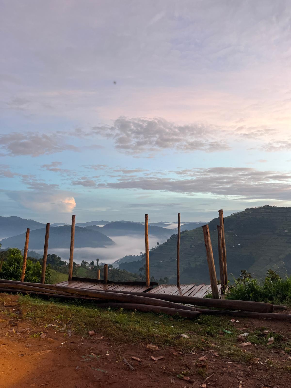
Drive one hour west from Bwindi to Lake Bunyonyi, a 25 km flooded river valley at 1,962 metres above sea level containing 29 islands. The lake has no hippos and no crocodiles; it is safe to swim, kayak or simply sit by. The hills are terraced to the waterline and the light across the water in the late afternoon is exceptional.
This is a deliberate decompression day after ten days of early starts, long drives and the emotional weight of the gorilla trek. Take a boat to one of the islands, hire a dugout canoe, swim, read or walk the hillside trails above the shore. The Katuna border is 32 km from the lake, a 40-minute drive; confirm logistics with your driver for the following morning.
Stay at Arcadia Lodge Lake Bunyonyi, with private deck views directly over the water.
Day 13: Cross into Rwanda, arrive Kigali
Drive south from Lake Bunyonyi through Kabale town (15 minutes north of the border, worth a fuel stop) to the Katuna crossing. The total drive from Arcadia Lodge to the border takes about 40 minutes. Allow 45 to 90 minutes at the crossing itself; both sides have standard passport control and customs. The East African Tourist Visa ($100, covering Uganda, Rwanda and Kenya on a single multiple-entry document) handles both sides if purchased at Entebbe on arrival; if not, Uganda exit stamp and Rwanda visa on arrival covers it cleanly. Do not carry fresh produce across. Arrive at the border no later than 5 pm to give comfortable buffer before closing time.
The drive from Gatuna (Rwandan side) to Gishwati National Park. It takes approximately 2.5 hours on well-maintained Rwandan tarmac. The transition is immediate: Rwanda's roads are among the cleanest and best surfaced in Africa, and the Thousand Hills landscape opens ahead with terraced ridges, church steeples on every summit and a density of settlement that is completely different from Uganda's sparser interior.
The Virunga volcanic chain appears to the north as you pass Musanze: Karisimbi at 4,507 m, Bisoke at 3,711 m and the lower peaks of Sabyinyo, Gahinga and Muhabura forming the border with the DRC. This is the same mountain range in which Dian Fossey worked and was killed in 1985; the Karisoke Research Centre she founded is still active.
Forest of Hope Guest House is the only accommodation inside Gishwati-Mukura National Park and a stay is required to access the park at all. The property is small: two en-suite rooms with private balconies overlooking the forest, plus a campsite. It is managed by the Forest of Hope Association, the community conservation organisation that initiated the reforestation of Gishwati after the forest was reduced to 2% of its original extent in the early 2000s through a combination of refugee settlement and illegal farming following the 1994 genocide. The guesthouse fee includes three meals, all guided activities and park access. Book by bank transfer months in advance; the two rooms fill far ahead.
The forest sits at altitude; bring layers. The view from the balcony at dusk over the forest canopy is one of the quieter highlights of the Rwanda section.
Day 14: Gishwati, overnight at Lake Kivu
The guided forest walk in the early morning afternoon covers regenerating forest that already holds chimpanzees (semi-habituated, sightings not guaranteed), golden monkeys, L'Hoest's monkeys and over 130 bird species including multiple Albertine Rift endemics. The forest sits at altitude; bring layers. The view from the balcony at dusk over the forest canopy is one of the quieter highlights of the Rwanda section.
The drive from Gishwati to Kibuye (Karongi) on Lake Kivu takes approximately one and a half hours, descending from the forest escarpment through terraced ridges before the lake appears below: 480 metres deep and shimmering at 1,460 metres above sea level, its surface a blue-grey that photographs cannot fully render.
Lake Kivu forms Rwanda's western boundary with the Democratic Republic of Congo; the hills on the far shore are Congolese. The lake holds an unusual deep-water chemistry: dissolved CO₂ and methane in quantities significant enough to be commercially extracted for electricity generation. This does not affect surface swimmers; it explains the lake's unusual depth profile and the slightly carbonated quality of its deep water.
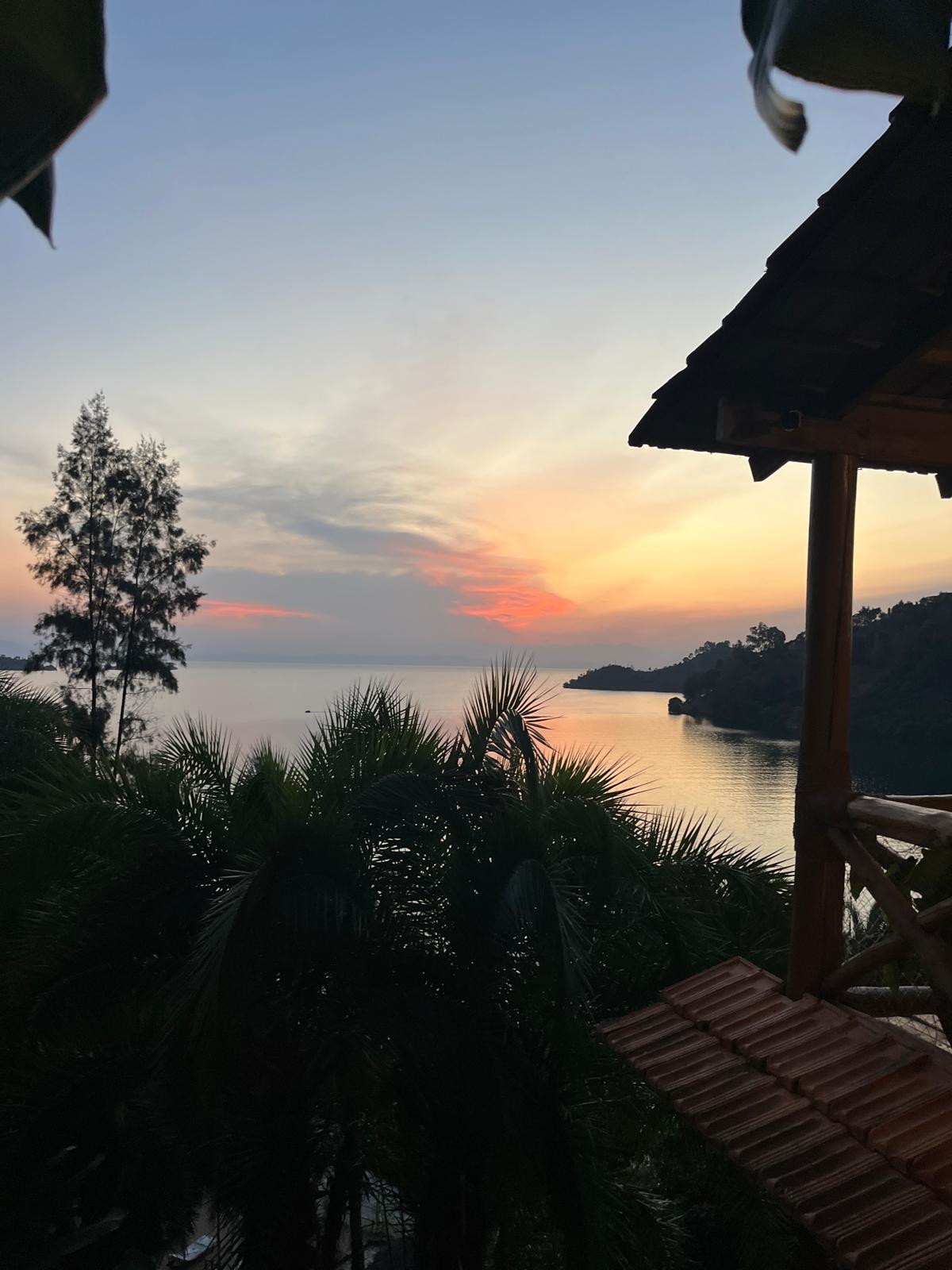
Cormoran Lodge sits on the lakeshore near Kibuye with direct water access. Kayaks are available; sunset kayaking as noted in the source material is specifically recommended and the view west over the lake in the late afternoon, with the DRC hills turning purple behind it, is one of the best pure landscape moments of the 17-day route. Swim in the lake if the day is warm; the water is clean and the altitude keeps it cool rather than cold.
Dinner at the lodge or in Kibuye town (10 minutes by car). Local restaurants serve fresh isambaza (small sardine-like lake fish, eaten fried and whole) and ndagala alongside rice and plantain at very low prices.
Day 15: Lake Kivu boat trip, Napoleon Island
Organise the boat through the lodge. A standard morning tour covers the Kibuye bay, the network of peninsula headlands and Napoleon Island (Île Napoléon), a small rocky island named for its shape when viewed from above. The hike to Napoleon's Hat, the island's high point, takes approximately 40 minutes and gives a 360-degree view over the lake and into the DRC on a clear day. Cormoran Lodge can arrange for the boat to include swimming alongside cattle: local herders sometimes drive cows across the lake channels between peninsula grazing areas, and the experience of swimming alongside a herd is one of those things that sounds absurd until you are doing it.
In the mid-afternoon Drive to Kigali (4 hours).
Day 16: Kigali
Start at a café in Kimihurura: Kivu Noir or Rubia Coffee Roasters, both in the neighbourhood of embassies and international organisations that have made Kimihurura one of the more interesting café districts in sub-Saharan Africa. Rwanda's specialty coffee industry is one of the most significant on the continent and the quality in the better Kigali cafés reflects that directly.
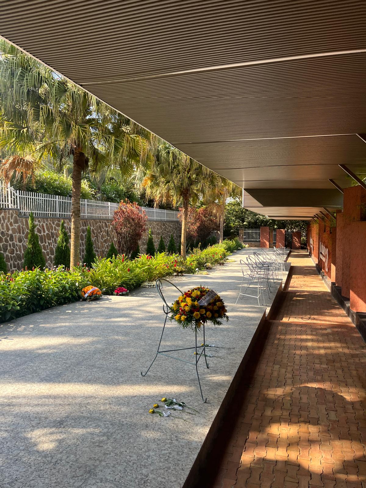
Kigali Genocide Memorial (afternoon): Built on a site where approximately 250,000 victims are buried in mass graves on the grounds. The permanent exhibition covers the history of Rwanda, the Belgian colonial imposition of ethnic classification cards that radicalized pre-existing tensions into explicit identity, the events of April to July 1994 in which approximately 800,000 to one million Tutsi and moderate Hutu were killed in 100 days, and the international community's failure to intervene. The final section covers other genocides of the 20th century. Allow two hours. Entry is free, guides are available. Do not rush it to reach the gardens.
Inema Arts Centre: Founded in 2012 by brothers Emmanuel and Innocent Nkurunziza, Inema is one of the most significant contemporary art spaces in East Africa: an open studio where resident artists work in full view of visitors and exhibitions rotate through the main gallery. The work engages directly with Rwanda's recent history, urbanization, gender and identity. Spend an hour.
Rebero Hill sunset: One of Kigali's hills with a 360-degree view across the city's volcanic ridges. Arrive before sunset.
Evening: Pre-dinner drink at Pili Pili, dinner at Repub Lounge (African regional food, consistently good), live music at Tania's Cuisine and Lounge afterward. Tania's is one of the better live music venues in Kigali, particularly on a Friday; the acts range from Afrobeats to Rwandan contemporary.
Day 17: Departure
Fly out from Kigali International Airport (KGL), which handles Rwanda's international routes; the departures process is efficient and the airport is compact.
.png)
.jpeg)

.jpeg)
.jpeg)
.jpeg)
.jpeg)
.jpeg)
.jpeg)
.jpeg)
.jpeg)
.jpeg)
.jpeg)
.jpeg)
.jpeg)
.jpeg)
.jpeg)
.jpeg)
.jpeg)
.jpeg)
.jpeg)
.jpeg)
.jpeg)